Saturday, February 27, 2010

Packing for Travel

I was digging through some older photos this morning (working on a photo book), and came across some pictures I took from packing for our trip to India and Italy in 2006:
The first picture makes this look like a lot of stuff, but it's exaggerated because everything is exploded out and piled up. Given all the stuff we wanted to do, and the gear I had at the time, it would have tough to go much lighter.
When we went to Norway this past summer, we did a lot of hut-to-hut hiking and almost no backtracking, so a lot of the time we had everything with us. That kind of travel makes going light particularly important. Technology helped, as I just brought a handful of compact flash cards instead of two portable hard drives for backing up photos. We also didn't do any camping, so I didn't need to carry a sleeping bag (I had one in India for the trekking in Sikkim). The Granite Gear backpack I took to Norway weighed about half of the Gregory I used in India, and I cut down on the smaller things as well: one reading book instead of two, a smaller first aid kit, slightly fewer toiletries, etc. Without food or water, my Norway bag probably weighed only 20 pounds or so.
The picture below shows everything I brought on the Norway trip. Top row: With the fully packed bag. Basic clothing, red puffy jacket, water bladder, gloves. (I lost my hat in Jutenheimen). Middle row: Tripod and other stuff sacks, camera case, day pack. Packed essentials. Footwear.
Everything in the bottom row is also in the middle row, these pictures just show what was stored in the red mesh pouches, camera case, and ziplock bags of maps and books.

Saturday, August 29, 2009

Mt. Maude - Spider Gap - Cloudy Pass - Image Lake - Buck Creek Pass Loop Backpacking Trip

This isn't really a trip report, more of a collection of notes. I wanted to write down some thoughts while they were still fresh in my mind, and didn't feel inspired to actually put them together into coherent prose.
Spider Gap - Buck Creek Pass Loop Backpack
Also, check out the route using Picasa's map view.
Sunday, August 16
  • No insoles in my boots! (Expletives deleted). Time to improvise. Cut insoles from the felt/rubber liner sheet in Amy's trunk. These insoles actually worked quite well --- my feet were definitely a bit sore after the last long downhill day, but no major problems.
  • Hiked from Phelps Creek Trailhead (3500') to Leroy Basin (around 6000'), maybe 3.5 miles on the main Phelps Creek trail, then another couple of miles up the unmaintained high-route trail. Set up camp. Climbed Mt. Maude (9082') via the standard southern route, first over the pass towards Ice Lakes then up gentle scree from there. Fairly straightforward. Descended by a more direct route on much looser scree. There would be danger of rockfall if multiple parties were on this descent, but otherwise not bad and saves quite a bit of time. But I wouldn't want to go up it. No mosquitoes.
  • Saw some deer in the basin in the evening while having dinner.
  • Dinner: Tuna Mac (angel hair pasta, packet of tuna, packet of cheese from a mac&cheese box, olive oil, powdered milk, spices). Could have used more spicing as the tuna wasn't marinated, but still quite good.
Monday, August 17
  • Back down to the main trail, a pretty brutal descent back to around 4100', then up to Spider Gap (7100'), down past upper Lyman Lakes and Lyman Lake (5500'), and up to Cloudy Pass (6438'). Probably around 10.5 miles and about 4000' elevation gain in total.
  • Took a bunch of pictures of small marmots in the basin in the morning, and also saw a very large rockfall (one horse-sized boulder and friends) come down into the meadow, in a line close enough to me that I took off running.
  • Bad flies in Spider Meadows, where we had lunch.
  • Took a good rest near some beautiful campsites just below spider gap -- apparently Larch Knob.
  • Mosquitoes at the upper Lyman lakes. We hoped wind would keep them down in Cloudy Pass, but they found us there in good numbers as well.
  • We camped quite close to the actual pass, but better views can be had by moving up the ridge closer to Cloudy Peak. We got in fairly late in the day (it was a long one), so we took the closest appealing option. The views were still great.
  • Fat marmots around Lyman Lake, the first of many such sitings.
  • Dinner: Freeze-dried Mexican beef & rice with tortillas and cheddar cheese. Chocolate-caramel pudding for dessert.
Tuesday, August 18
  • A short day: from Cloudy Pass (6438') through Suiattle Pass (5893') along Miners Ridge to Image Lake (6056'). Probably around 6 miles total.
  • Pumped water at the lake outflow, had a good snack and rest, went for a swim. Walked around the lake in bare feet in wonderful mud. Highly recommended.
  • The views from the walk along the ridge above Image Lake are spectacular in all directions, and should be considered a mandatory part of any visit to the lake in my opinion.
  • Dinner: First course of instant thai ginger soup (rice noodle based, from Fred Meyer, quite good), followed by mushroom & herb coos-coos mix with olive oil, sausage, and lots of pine nuts. A square of good dark chocolate for dessert.
  • Some bugs at the lake and at camp, but overall not too bad.
Wednesday, August 19
  • We traversed the ridge above Image Lake northeast to the highpoint around 6800', then followed the ridge spur south to rejoin the trail. Back along Miners Ridge, down across Miners Creek, and up to Middle Ridge, then the spur trail 1 mile farther to Sheep Camp (around 6400'). About 9.8 miles (plus another 0.5 mile to our camp).
  • A few patches of blueberries along Miners Ridge about a mile from Image Lake were perfectly ripe; we picked a bunch.
  • We actually camped on a bench overlooking the main basin at Sheep Camp. It's a beautiful spot, complete with a perfect square flat granite rock for a kitchen counter.
  • Dinner: Instant everything-flavored mashed potatoes with an added package of pre-cooked crumbled bacon, and cheddar cheese. Pistachio pudding for dessert.
  • Bugs weren't bad when the sun was high, but the mosquitoes got mean as the sun went down. Each time I would try to make a loop to tie a knot for the bear bag, two would land on the back of my hand and start stabbing before I could finish, necessitating a swat and hence starting the knot over.
Thursday, August 20
  • From our site on Middle Ridge (6500'), down to Small Creek (~5100'), up to Buck Creek Pass (5900'), and up the old High Pass trail to the saddle south of Liberty Cap (6400'). Climbed up Liberty Cap (~6700') looking for good campsites, but didn't find anything great. Back to the saddle, I went downhill and found water. We set up camp there, hung the bear bag, and continued towards Triad Lake on the trail. It was much smoother going than we expected, and we were at the saddle above Triad Lake in about 30 minutes ... I wish we'd set up camp in that area. Climbed to point 7625'. About 5 miles to the camp, and maybe another 4-5 miles of other hiking.
  • Heavy haze and smoke in the sky in the morning caused some concern about wildfires.
  • We saw a black bear climbing over a very steep rock ridge just below point 7625'. We waited until we were fairly certain the bear had descended the far side before climbing up that way. We also saw a large hawk of some kind soaring at about our level over Buck Creek.
  • Breakfast: Granola with powdered milk and over a cup each of wild blueberries, picked the day before at Image Lake.
  • A few drops of rain, and lightning in a large thunderhead North of us in the evening. Temperature dropped in the night, probably the coldest of the trip (still pretty warm) by morning.
  • Dinner: Freeze-dried turkey tetrazzini, mint-chocolate pudding.
Friday, August 21
  • From our camp south of Liberty Cap (6400'), back through Buck Creek Pass, and down to the trinity trailhead (2800'), about 11.3 miles, then another 2-3 miles for me to do the car shuttle, back to the Phelps Creek Trailhead (3500').
  • In the morning the tent, bearbag, and vegetation were all quite wet. I'm not sure if it was a light rain or jut condensation.
  • Milkshake and cobbler (very good) and pulled pork and salmon burger (pretty good) at the 59er dinner just back on Hwy 2.
General notes:
  • About 49 miles hiking with our packs plus another 10 or so miles of day-trip hikes, and about 14,200' of elevation gain. (I computed elevation gain by comparing our high points and low points, it doesn't account for the smaller ups and downs in the trails).
  • Pack weight:
    • Food: about 21 lbs of which I probably carried (and ate) 55%, so 11.5 lbs initially. For a 6-day trip this was a little less than I would normally carry (I usually figure 2 lbs per person-day), but it ended up being fine; I could certainly have eaten more, but I was also never really hungry.
    • Camera gear (5dmkII, 24-105, 70-300, Slik Sprint Pro tripod), about 8.4 lbs.
    • Group gear carried (stove, fuel, kitchen gear, most of tent): 4.77 lbs
    • Personal gear, including pack: 10.7 lbs (plus 1.7 lbs worn).
    • Average 2L water carried, for 4.4 lbs
    • Total: about 39.7 pounds
    • The above was all calculated in excel from a gear list ... actually weight is probably a bit heavier for some stuff sacks and other random things not included in the above total.
  • Our trash weighed about 253g (8.9oz) at the end of the trip, not counting the 2 large Aloc Sacks we used to store the food, the bear-bag stuff sack, and 3 or 4 small ziplocks that still had some food left. So packaging weight is somewhat significant. Note that this was after almost complete repackaging into light-weight ziplocks, typically holding two portions of food each per meal.
  • Bear bagging required some tricky engineering using multiple trees, and still didn't always produce hangs up to the full recommended specification. As much as I'd hate to carry the extra weight, I'll seriously consider bear canisters next time I'm on a trip where most of the camping will be near treeline.

Saturday, June 13, 2009

Two Short Backpacking Trips

Lots going on lately, Amy and I are packing up our things in Pittsburgh and preparing to move to Seattle. And in between leaving Pittsburgh and arriving in Seattle we have a trip to Norway to plan. I did have the chance to get out for a couple of extended-weekend backpacking trips, though. No full trip reports, but the Picasa albums have captions and you can use the map view to see where I was.

Enchanted Valley Backpacking
Zion Backpacking

Also, a fun 3-day climbing trip down to the Red River Gorge:

Red River Gorge

Saturday, March 14, 2009

Kalalau Trail Backpacking Trip

Kalalau Beach.
Sunday, December 28: We got up early in Honolulu, drove to airport, and easily caught the 7:38am flight to Lihue, Kauai. We checked our two backpacks with all our food, but no water or fuel (when you check backpacks, ask to have them placed in large plastic bags). I carried on my camera and our two RidgeRest sleeping pads rolled together, Amy carried on a small book-bag with a clean change of clothes and some toiletries for each of us to stash at our hotel. We landed in Kauai around 8:15am and picked up our checked bags. It turns out the Lihue - Hanalei bus doesn't run on Sundays, so after failing to bum a ride at the airport we walked out to the Kapule Hwy (51) and hitched a ride to Kapa'a after about a 15 minute wait. We ended up hitch-hiking for the rest of our transportation on Kauai, and 15 minutes ended up being the longest we ever waited --- a big thanks to all the friendly locals and visitors who helped us on our way. We got another ride to Hanalei, where we picked up a fuel canister (the larger 8oz size, unfortunately) and dropped off our clean clothes at the Hanalei Inn. Another couple of rides got us to the trailhead, and we started hiking around 12:30pm.
Amy on the (muddy) trail, day one.
We took our time, stopping at the beach at Hanakapiai and some of the other great viewpoints along the way; we arrived at Hanakoa camping area just as it was getting dark (around 6pm).

Monday, December 29: We had a leisurely morning, broke camp, and then hiked up to Hanakoa falls, an easy trip from the campground, then proceeded to Kalalau. Again we took our time, arriving at the beach a little before 5pm. After ditching our packs and walking around a bit to get a feel for the place, we picked a great little camp site under a tree a bit closer to the beach than the rest. There was just enough room to pitch the tent, and a little rock path down to the beach, with some larger rocks perfect for setting up a kitchen. At least, perfect until the sun goes down and the cockroaches come out ... but I can't really complain.

Tuesday, December 30: Yet another leisurely morning, this time on the beach. Around 11:30 we got motivated and started a hike up the Kalalau Valley trail. When we returned to the beach in the late afternoon, we could see a big squall farther down the coast slowly rolling our way.
By a beautiful small waterfall in the Kalalau valley.
We managed to get water from the waterfall at the end of the beach and have dinner with only a few raindrops falling, but once we were in the tent it rained most of the night, quite hard at times.

Wednesday, December 31: My watch alarm went off at 6am, as we wanted to get an early start on the long hike out so we could enjoy ourselves and still have time to relax in Hanalei. Since it was still sprinkling, we packed up and had breakfast in tent. There was some light by 7am. We finished breaking camp and (rather accidentally) took a detour through some of the higher campsites (including "Honeymoon Suite") above the beach, hiking in earnest by 8:30am. Heavy rains caught up with us 2 or 3 miles from the trailhead at Haena, which turned out to be more refreshing and fun than anything else (though some of the surprised day-hikers we passed didn't seem to think so). The rivers were up slightly from the previous night's storm, but still very manageable. We reached the trailhead around 3:45pm.
On the way to the airport, Jan. 1


What worked:

  • Cook system: pocket rocket stove, 1.3L titanium pot, 2 ziplock 3-cup round bowls: quick, light, and easy.
  • Our REI Quarterdome tent survived it's first real test in a hard rain. When we took it down we found a puddle under the floor, but we stayed dry inside.
  • I used my old Asics running shoes with medium-weight socks and short gaiters, which worked well. A better sole would have been nice in the mud, but the shoes were adequate, they drained quickly and so hiked fine even after getting totally submerged.
  • Convertible pants: The trail is overgrown at places, especially beyond the first two miles. If your skin is sensitive to brush rubbing against it, you may want long pants, but if it's hot and humid you may want shorts --- convertibles let you decide (and change your mind) while on the trail.
  • Camera gear: A polarizing filter is very handy for cutting the glare off plants and the water, it's amazing how much richer the greens come out when using one. My Slik Sprint Pro travel tripod also worked well ... it's not nearly as sturdy as a heavier rig, so I sometimes use it with the self-timer, but having good camera support opens up a lot of options.
  • There is risk of leptospirosis in the fresh-water sources on the Kalalau trail. Filtering alone is not enough, as the tiny bacteria will pass easily through filters with a pore size of more than 0.2 micron (which happens to be the filter size on our SweetWater filter). [leptospirosis.org]. We filtered and then added a sodium hypochlroite solution (and/or boiled), but I haven't been able to find an authoritative reference that recommends this (though MSR did confirm it should be sufficient over email, and we didn't get sick). If going again I'd probably leave the filter and just use iodine tablets.

Things to reconsider for next time:

  • Sleep system: We each brought a light silk sleeping bag liner, a RidgeRest 3/4 length pad, and we shared one synthetic sleeping bag as a comforter. This worked okay, but we could have gone lighter and been more comfortable with different gear. RidgeRest pads are cheap, light, and durable, but they just aren't very comfortable. I can sleep on my back on one reasonably soundly, but there isn't enough padding on my hip when I sleep on my side, so I tossed and turned a lot. We did need some extra warmth beyond the sleeping bag liners, but the sleeping bag was overkill. The surf is also surprisingly loud if you're camping near the ocean, and while you can get used to it, some might want earplugs.
  • The trail can be hot, humid, sticky, and muddy --- some babywipes for the face would have been a nice luxury, though there is also fresh water to wash in.

Pictures

I recommend going directly to the Picasa album and using the full-screen slideshow.
Kalalau Trail Backpacking

Sunday, March 8, 2009

I spent most of the morning ordering a new camera and accessories, but given the unusually good weather, it would have been wrong not to actually take some pictures as well. So, I took "the small camera" (a Ricoh GX100) for a walk this afternoon, with the intention of just playing around with the manual-focus macro mode and different aperture settings. But the last few days of good weather appear to have tricked a few flowers into coming out, and I got some interesting shots. Unfortunately my Gorillapod broke yesterday, it would have been perfect for the kind of shooting I was doing. Most of the shots used a 2 second or 10 second self-timer, with camera support improvised with a bag of kidney beans in a ziplock bag (or just setting the camera on the ground). Depending on the support, 2 seconds may not be long enough for vibrations to damp out, and so a 10 second delay seems to give better results (assuming the light doesn't change). 

The Ricoh is great for this kind of work, because it's small enough you can position in the scene without disrupting things.   Unfortunately, such camera placements often make it pretty hard to evaluate the composition. It would be awesome to have a direct feed from the camera's sensor to a laptop or other nice detached screen, especially with support for 100% zooming in to support manual focus. A focus-bracketing mode would also be great. Hopefully someday you'll be able to buy cameras that are open for software development (like Android phones)---it would open up some really interesting possibilities for digital photography.
Picasa Album:
Around the Block

Saturday, October 11, 2008

Fairview Dome and Central Pillar of Frenzy

I took two days off from a work trip to meet Stewart in Tuolumne.  We climbed the Regular Route on Fairview Dome (5.9, 12 pitches) and the Central Pillar of Frenzy on Middle Cathedral (5.9, 5 pitches) Pictures are up on Picasa:

Here are my notes:
Tuesday, 9/30
  • Regular Route, Fairview Dome.  5.9, 12 pitches.   We  started around 9am, after hesitating a bit due to some suspicious moderately puffy clouds building in the sky.  They didn't look too bad, but the weather report I had yesterday suggested a 40% of rain (though not thundershowers).  In the end we decided to go for it, bringing an extra rope so we could bail quickly if needed; we figured we could come back the next day to retrieve gear if needed.  There was one party ahead of us on the route, they were at the top of the 1st pitch when we started.  We swung leads, with Stewart taking the crux first pitch, which probably went at 5.9+ given the wet conditions.  Stewart took a fall at the crux, got it the second try, and continued to the higher belay at the tree.  That gave me the (now short) second pitch; Stewart got the beautiful third pitch, and I took the 4th, bringing us through the 5.8 pitches (though after the first pitch, the other 3 felt easy).  From there, Stewart led a long pitch, I led another pitch (which we finished with some simuling), and then Stewart led a long simul block to the summit.  The other party was moving at about the same speed, we passed them at the very top when we were simul-climbing and they were still pitching it out.  We summited around 1:30pm, so about four and a half hours climbing ... not bad for a 12 pitch route.
Wednesday, 10/1:
  • Central Pillar of Frenzy, Middle Cathedral.  5.9, 5 pitches.  Super classic, five pitches of 5.8 - 5.9 cracks of all sizes.  Easily one of the best routes I've every climbed.   More beta and some good pictures from summitpost.  I led the first pitch, which worked me a little bit, but the rest was a blast.  The 5.8 "offwidth" on p3 isn't bad at all, cupped hands and a few fist jams with good feet, only one short awkward section --- you do probably want 4 or so pieces in the 3.5 -4" range to protect it well, you could possibly get by with a couple fewer if you are willing to run it out or walk them up.
  • Bishop's Terrace, Church Bowl (2 pitches, 5.8, climbed as a single 200' pitch).  Another beautiful line with a little bit of everything.  Amazingly we didn't have to wait in line for this one.  Stewart led this last time we were in the valley, so this time I got the sharp end.  Only key beta: make sure you save a #2 BD for the last 15' of perfect hands, and save a #4 for the wide section at about 2/3rds height.  There are solid rests every 10-20', and plenty of good gear options.  If doing it as a single pitch you probably want to solo the first 15' step, then you can cover another 20' of easy ground before placing gear.
My apologies for the crappy formatting, btw, ... pasting into the blogger edit window from Google docs works (how to put this?) ... poorly. And it's nice outside and I don't feel like wrestling with blogger to get it to look better.

Tuesday, September 16, 2008

Climbing and Mountaineering Resume

As a member of the program committee for the Explorers Club of Pittsburgh Mountaineering School, I was asked to prepare a climbing resume.  I ended up having a lot of fun putting it together, and since this is the web and all, I added lots of links to pictures, trip reports, and route information; since that might make it interesting to other people, I figured I'd go ahead and post it here as well.

Climbing and Mountaineering Resume

I've been hiking and scrambling in the mountains as long as I can remember.  I grew up in Oregon, and my family made regular excursions into the wilderness throughout my childhood years.  When I was six years old, my father, an accomplished climber himself, began teaching me basic mountaincraft, including how to plunge step and use an ice axe.  During a three-week Outward Bound mountaineering course during high school, I gained an increased appreciation for the rhythm of being in the wilderness and the rewards of facing challenges in the mountains.  Through the rest of high school and college I did occasional climbs with friends and family, but it was during my year-off before graduate school that I began climbing some of the larger Cascade volcanoes, including Mt. Hood, Mt. Adams, and Mt. Rainier.  During graduate school at CMU in Pittsburgh I made regular trips back to the West Coast, where I often climbed with my good friend Stewart.  While I had done occasional rock climbing for many years, I began climbing more seriously and learning to lead climb in the fall of 2003 at Seneca Rocks.  The same year I was a student in the ECP Mountaineering School, where I learned basic ice climbing and did my first rock leads in winter conditions.  I have returned as an instructor in the Mountaineering School every year since then.   For the past few years my personal climbing goals have focused on technical alpine rock routes, with climbs in the North Cascades, Rocky Mountains, High Sierras, and the Bugaboos.  In addition to mountaineering, I enjoy travel, backpacking, and canyoneering as other ways to experience the wilderness --- but usually such trips turn into at least an opportunity for some good scrambling.

Alpine Climbs and Long Rock Routes

In reverse chronological order

Spring 2008
Summer/Fall 2007
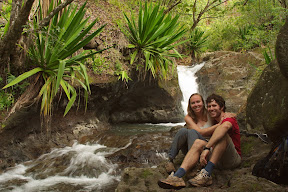
  • Spearhead, North Ridge  (III 5.6), attempt, with Amy.  Bailed (4 rappels and some scrambling) in rain and hail  (pictures).
  • Longs Peak, Keyhole Route, attempt to within 500' of the summit (with Amy and Jeff Parker).  Turned back due to icy conditions and lack of appropriate gear.
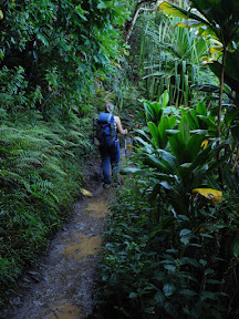
  • Petunia Peak Ridge Traverse, Olympic Mountains.  Three days of scrambling and ridge walking, including an exposed 4th class route on the Southeast side of Petunia Peak (pictures, short blog posttrip report from Stewart)
Summer 2005
Winter 2004-2005
Summer 2004
Pictures from these climbs and some of the other earlier ones below can be found on my old pictures site.
Winter 2003-2004
  • "Pineapple Pinnacle" (sub-peak next to The Tooth), with Stewart.
Summer 2003
Summer 2002
Summer 2001
Summer 2000
Winter 1999-2000
  • Mt. HoodSouth Side Route, Winter attempt, Whitman College Climbing Club.  Spent a night camped in full conditions, one party member became hypothermic, which we were able to effectively treat in the field.
Early Scrambles and Climbs (1992-1999)
In the Oregon Cascades:
In the North Cascades, on Outward Bound.
  • "Kangaroo Temple", Kangaroo Ridge, North Face Standard Route (5.4?).  My first alpine trad climb.
  • Golden Horn
  • Some other 2nd and 3rd class scrambles.
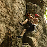
Rock Climbing
Traditional lead climbing (5.10a on a good day) and sport (to 5.11b or so), at locations including Seneca Rocks, the New River Gorge, Stone Mountain, Linville Gorge, Red River Gorge, Joshua Tree (pictures, more pictures), Yosemite Valley, Tuolumne Meadows, Owens River Gorge, Lover's Leap, Squamish, City of Rocks (pictures), Eldorado Canyon, Lumpy Ridge, and Red Rocks.
Backpacking, Canyoneering, and Other Trips
  • Spring 1998: Five day backpacking trip in the maze district, Canyonlands NP, Utah.  Some rappelling and scrambling.
  • Summer 2000: Backpacking with Dave Shelly in Alaska (Rabbit Lake, Dixie Pass, McCarthy).  Five day solo backpack in Denali National Park.
  • Fall 2000: Hikes in Idaho, Montana, Wyoming, Colorado, and Utah during cross-country road trip.
  • Summer 2001: Hikes, scrambling, and exploration in the Swiss Alps, Siberia, Mongolia, and China.
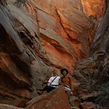
  • Spring 2003: Canyoneering in Southern Utah: Pine Creek, Peekaboo, Spooky, Brimston, Egypt 3, and Zebra canyons.
  • Spring 2006: Nine days on the Goecha La Trek, below Kanchenjunga, Sikkim, India.
  • Spring 2008: Five day descent of Death Hallow Canyon, Utah.  Trip Report and pictures.
  • Summer 2008: Five day backpacking trip in Pasayten Wilderness; several 2nd-3rd class summits.